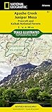
National Geographic Trails Illustrated Map Apache Creek, Juniper Mesa, Prescott & Kaibab National Forests, Arizona, USA
価格: ¥1,433
カテゴリ: 地図
ブランド: National Geographic
Apache Creek/Juniper Mesa Trails Illustrated topographic map is the most comprehensive available for outdoor enthusiasts of all types. Designed to be easy-to-read, yet highly detailed this map includes a comprehensive road and trail network distinguishing between major, secondary, high-clearance, hiking, motorized and non-motorized trails. All forest roads are labeled with their official road number and trails are clearly identified with their given name. Boundaries are color-coded and clearly shown for National Forest, Ranger Districts, Wilderness Areas, County/Regional Parks, and State Wildlife Areas. Additionally, Arizona Game Management Unit (GMU) boundaries and public and private lands are clearly identified. An extensive collection of important and unique locations are pinpointed on the map including: ranger districts, campgrounds, picnic facilities, trailheads, gates, boat launches, ATV trails, motorcycle trails, shooting ranges, and recreation sites with universal access capabilities. Every National Geographic Trails Illustrated map is an essential tool for safely navigating the backcountry with GPS or compass as they are clearly marked with compass rose with magnetic declination, scale bar, and full legend. Some of the places shown on the east side of the Apache Creek/Juniper Mesa map include: Prescott National Forest, Verde River, Woodchute Wilderness, Great Western Trail, Mingus Mountain, Alto Pit OHV Area, Granite Mountain Wilderness, Upper Verde River State Wildlife Area, and more. The west side of the map features: Prescott National Forest, Apache Creek Wilderness, Juniper Mesa Wilderness, and extensive OHV trails near Denny, Stinson, and Cottonwood mountains. The map is two-sided. Apache Creek and Juniper Mesa adjoins our Sycamore Canyon map to the east and our Bradshaw Mountains map to the south.
Printed o
関連商品
- National Geographic Canyons of the Escalante Trails Illustrated Map: Grand Staircase - Escalante NM (National Geographic Trails Illustrated Map)
- National Geographic Trails Illustrated Map Glen Canyon National Recreation Area: Utah / Arizona, USA
- National Geographic Trails Illustrated Map Mazatzal & Pine Mountain Wilderness Areas: Coconino, Prescott & Tonto National Forrests, Arizona, USA
- National Geographic Trails Illustrated Map Superstition & Four Peaks Wilderness Areas, Tonto National Forest: Arizona
- National Geographic Trails Illustrated Map Salt River Canyon, Tonto National Forest: Arizona
- National Geographic Trails Illustrated Map Grand Canyon: Bright Angel Canyon North & South Rims National Park: Arizona USA
- National Geographic Trails Illustrated Map Mogollon Rim Munds Mtn, Apache-Sitgreaves, Coconino & Tonto National Forests: Arizona
- National Geographic Trails Illustrated Map Flagstaff / Sedona, Coconino & Kaibab National Forests: Arizona, USA
- National Geographic Trails Illustrated Map Paria Canyon, Kanab - Arizona, Utah: Vermillion Cliffs National Monument, Grand Staircase-Escalante NM